Sonepur(SUBARNAPUR) District Odisha- A Complete Guide(2023)
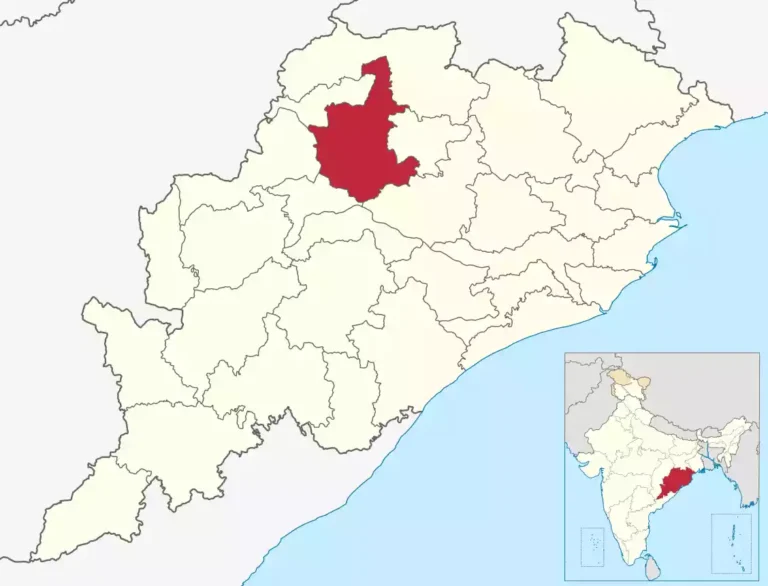
Subarnapur district, also known as Sonepur district, is a district located in the western part of the Indian state of Odisha. The district headquarters is located in the town of Subarnapur.

| Country | |
|---|---|
| State | |
| Region | Western Odisha |
| Established | April 1st, 1993 |
| Headquarters | Subarnapur |
| Total Area | 2,337 km2 (902 sq mi) |
| Official Languages | Odia, English |
| Spoken Languages | Sambalpuri Dialect |
| Time zone | UTC+5:30 (IST) |
| PIN Codes | 767 xxx |
| Vehicle registration | OD 31 |
| Nearest city | Balangir |
| Precipitation | 1,443.5 millimetres (56.83 in) |
| Avg. annual temperature | 30 °C (86 °F) |
| Avg. summer temperature | 45 °C (113 °F) |
| Avg. winter temperature | 24 °C (75 °F) |
Geographical Overview
Subarnapur District shares its boundaries with the districts of Bargarh to the north, Balangir to the east, and Boudh and Sambalpur to the south.
The district covers an area of approximately 2,337 square kilometers (902 square miles). The terrain of Subarnapur District is characterized by undulating plains and hills, with an average elevation ranging from 150 to 600 meters (490 to 1,970 feet) above sea level. The landscape is predominantly agricultural, with fertile alluvial soil supporting the cultivation of crops such as paddy, pulses, oilseeds, and vegetables.
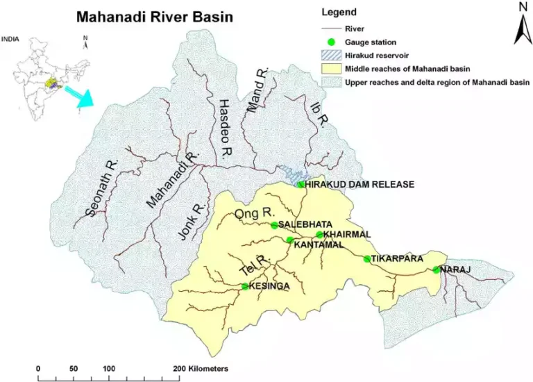
The major river in the district is the River Tel, which flows through the central part of Subarnapur and serves as a lifeline for agriculture and irrigation purposes. The district also has several small rivers and streams, which further contribute to its water resources.
Subarnapur District experiences a tropical monsoon climate, with hot summers and mild winters. The summer season starts in March and lasts until June, with temperatures often exceeding 40 degrees Celsius (104 degrees Fahrenheit). The monsoon season arrives in late June or early July and continues until September, bringing heavy rainfall to the region. The winter season, from November to February, is relatively mild, with temperatures ranging from 10 to 25 degrees Celsius (50 to 77 degrees Fahrenheit).
Transportation and Connectivity
| By Air The nearest Airport is Bhubaneswar Airport- 276 Km By Train Nearest Railway Station is Balangir -50 km. By Road From Bhubaneswar, it is 275 km on the N.H. 57 or 276 km on the N.H. 55 (via Badakera-Cuttack Rd.). |
Administrative Divisions
| Sub-Divisions | 1. Birmaharajpur 2. Subarnapur |
| Blocks | 1. Binika 2. Biramaharajpur 3. Dunguripalli 4. Sonepur 5. Tarva 6. Ullunda |
| Tahasils | 1. Binika 2. Biramaharajpur 3. Dunguripalli 4. Sonepur 5. Tarva 6. Ullunda |
| Panchayats | 109 Nos |
| Villages | 962 Nos |
| Parliamentary Constituencies | 1. Bolangir |
| Assembly Constituencies | 1. Birmaharajpur 2. Sonepur |
Police Stations
| Sl. No. | Name of the Post | Telephone No. |
|---|---|---|
| 1 | Subarnapur P.S. | 06654-220220 |
| 2 | Tarva P.S. | 06654-286086 |
| 3 | Binka P.S. | 06654-283004 |
| 4 | Dunguripali PS | 06653-270024 |
| 5 | Rampur PS | 06653-276032 |
| 6 | Biramaharajpur PS | 06651-254277 |
| 7 | Ullunda PS | 06651-218181 |
| 8 | Subalaya PS | 06651-247700 |
| 9 | Energy PS, Subarnapur | N.A. |
Helpline Numbers
| Description | Number |
|---|---|
| Local Police Station | 100 |
| Elder Person Help Line | 1090 |
| Women Help Line | 1091 |
| Children Help Line | 1098 |
| Fire Help Line | 101 |
| Ambulance Help Line | 108 |
| Janani Ambulance Help Line | 102 |
STD Codes of the District
| Sl.No. | Area | STD Code |
|---|---|---|
| 1. | Biramaharajpur | 06651 |
| 2. | Subarnapur | 06654 |
Tourist Places
| Bhima Bhoi Samadhi Pitha , Khaliapali | |
| Lankeswari Temple | |
| Rameswar Temple | |
| Patali Srikhetra | |
| Pancharatha Temple | |
| Papakshya Ghata | |
| Subarnameru Temple |


