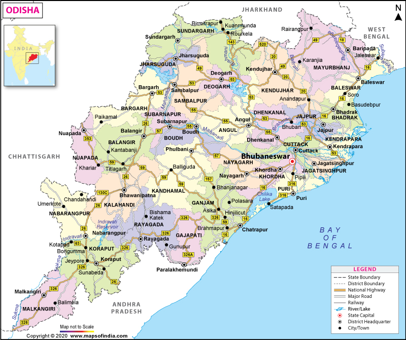
Odisha Map in 2023
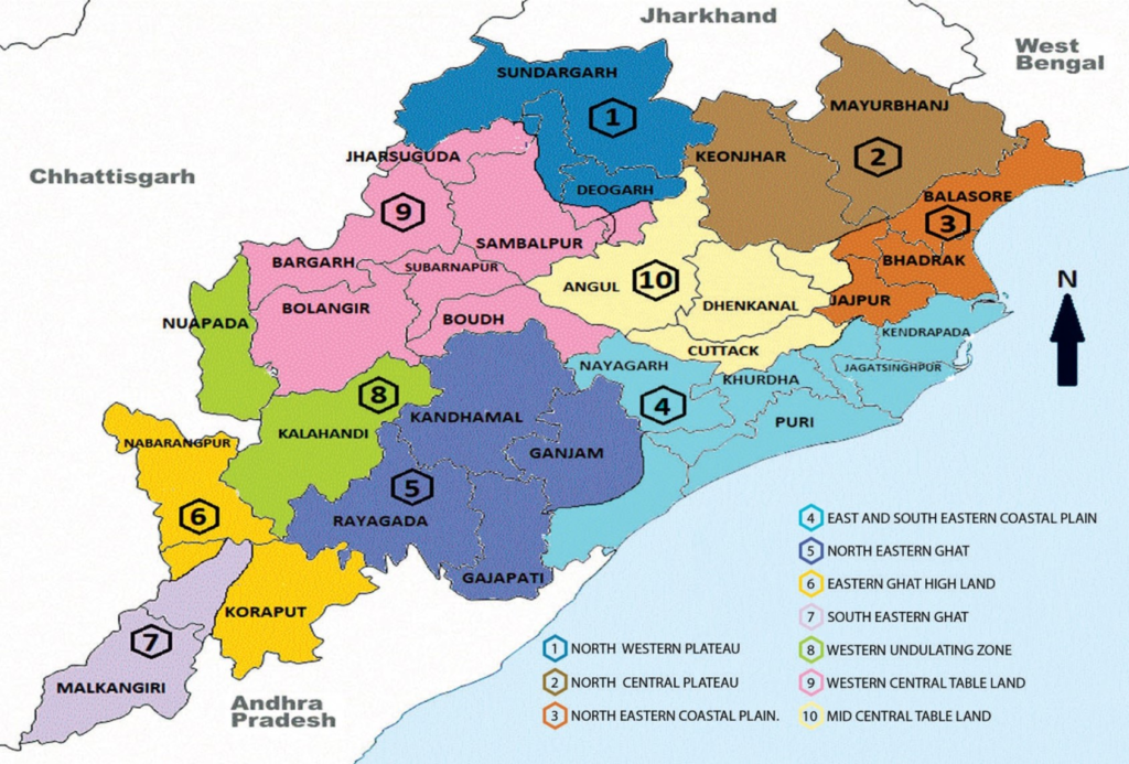
Odisha, also known as Orissa, is a state located on the eastern coast of India. It is the 8th largest state in terms of area and the 11th largest in terms of population. The Odisha Map is bordered by West Bengal to the northeast, Jharkhand to the north, Chhattisgarh to the west, and Andhra Pradesh to the south. The Bay of Bengal lies on the eastern side of the state.

Key features and information about the Odisha Map:
- Capital City: Bhubaneswar
- Major Cities: Cuttack, Puri, Rourkela, Sambalpur, and Berhampur.
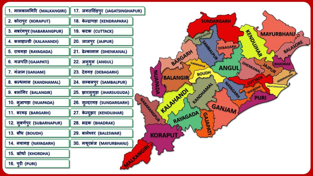
- Districts: Odisha is divided into 30 districts, including Cuttack, Puri, Ganjam, Khordha, Mayurbhanj, Kendujhar, and Balasore.
- Geographical Features: The state is characterized by a diverse landscape, including coastal plains, rolling hills, plateaus, and dense forests. The Eastern Ghats, a mountain range, runs parallel to the coast.
- Rivers: Odisha is home to several major rivers, including the Mahanadi, Brahmani, Baitarani, Subarnarekha, and Rushikulya.
- National Parks and Wildlife Sanctuaries: The state is known for its rich biodiversity and has several national parks and wildlife sanctuaries, including Bhitarkanika National Park, Simlipal National Park, Satkosia Tiger Reserve, and Chilika Lake (the largest brackish water lake in Asia and a Ramsar site).
- Temples: Odisha is famous for its ancient temples, especially the Jagannath Temple in Puri, which attracts millions of devotees every year. Other notable temples include Lingaraj Temple in Bhubaneswar and Konark Sun Temple, a UNESCO World Heritage Site.
- Beaches: The state has a long coastline dotted with beautiful beaches, such as Puri Beach, Chandipur Beach, and Gopalpur-on-Sea.
- Airports: The major airports in Odisha are Biju Patnaik International Airport in Bhubaneswar and Jharsuguda Airport in Jharsuguda.
Road Maps Of ODISHA
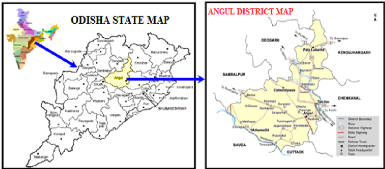
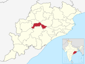
District Maps Of ODISHA
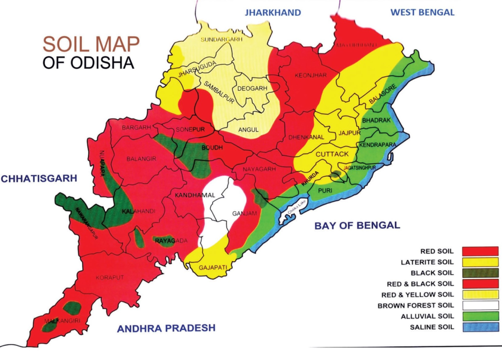
Soil Maps Of ODISHA
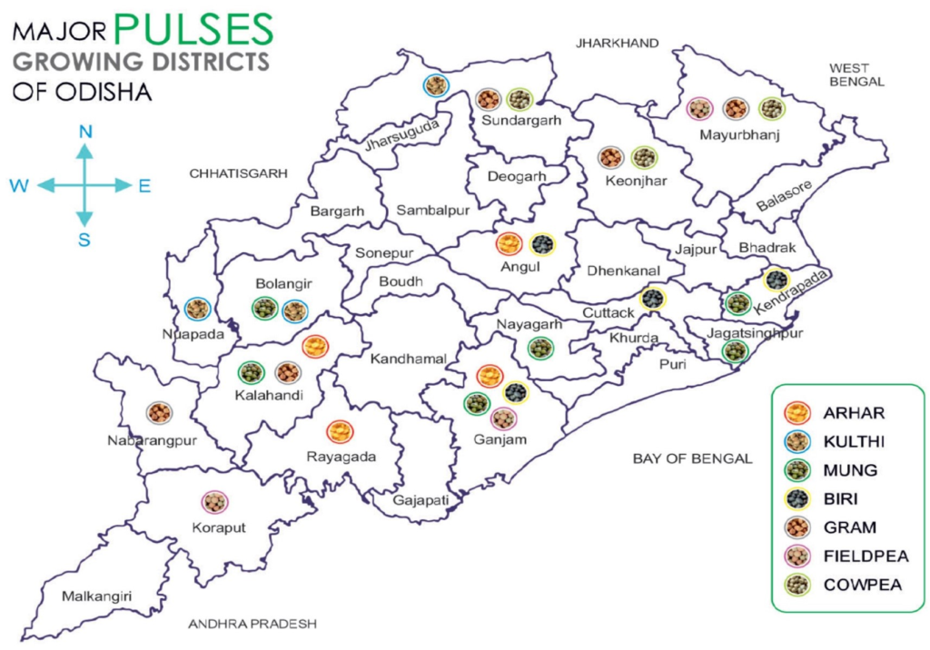
Pulses Growing Maps Of ODISHA
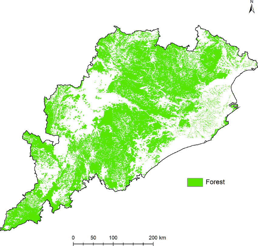
Forest Map Of ODISHA
Land Map Of Odisha Map
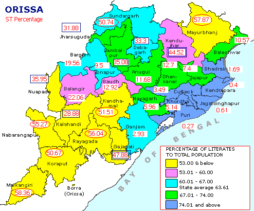
ST % Map Of ODISHA
River Map Of ODISHA

Altitude Map Of ODISHA

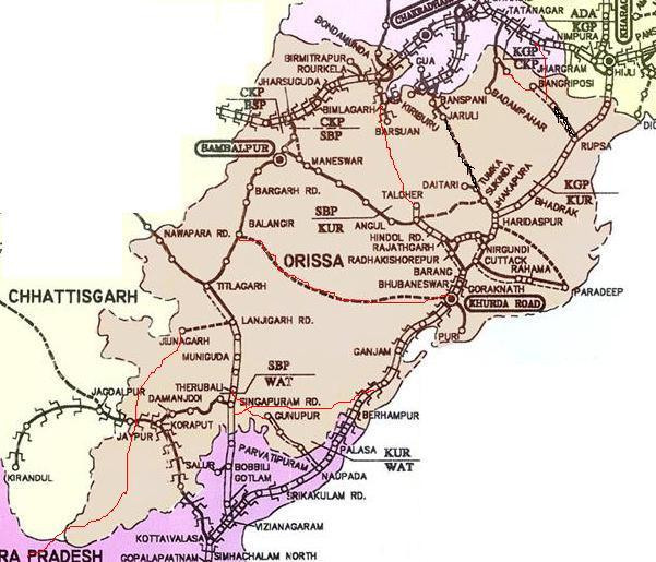
Railway Map Of ODISHA
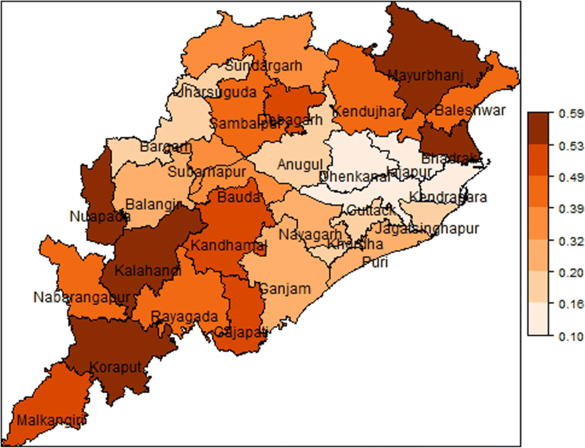
Porevity Map Of ODISHA
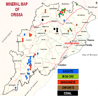
Mineral Map Of ODISHA