Balasore District Odisha- A Complete Guide(2023)
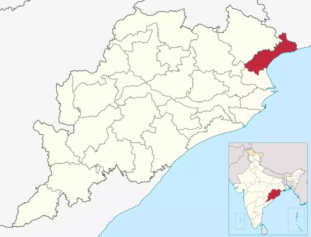
Balasore District is a district located in the state of Odisha, India. It is situated on the northeastern coast of the state and is part of the northern region of Odisha known as North Odisha. The district headquarters is in the city of Balasore.

| Country | |
|---|---|
| State | |
| Headquarters | Balasore |
| Total Area | 3,634 km2 (1,403 sq mi) |
| Elevation | 90.08 m (295.54 ft) |
| Official Languages | Odia and English |
| Time zone | UTC+5:30 (IST) |
| PIN Code | 756 xxx |
| Vehicle registration | OD-01 |
| Coastline | 81 kilometres (50 mi) |
| Precipitation | 1,583 millimeters (62.3 in) |
| Avg. summer temperature | 43.1 °C (109.6 °F) |
| Avg. winter temperature | 10.6 °C (51.1 °F) |
Geographical Overview
Location and Area: Balasore District is situated between 21° 3′ N and 21° 59′ N latitude and 86° 20′ E and 87° 29′ E longitude. It covers an area of approximately 3,634 square kilometers.
Terrain: The district’s terrain is diverse and characterized by coastal plains, river valleys, and some hilly regions. Towards the east, the land slopes gently towards the Bay of Bengal, forming the coastal plains, while the northern parts have some undulating hills.
Rivers and Water Bodies: Balasore District is crisscrossed by several rivers and their tributaries. The major rivers include the Subarnarekha, Budhabalanga, and Jaleswar, which flow through the district and eventually empty into the Bay of Bengal. These rivers and their floodplains play a crucial role in agriculture and local livelihoods.
Climate: The district experiences a tropical climate with distinct wet and dry seasons. Summers are hot and humid, while the monsoon season, which usually lasts from June to September, brings heavy rainfall. The winters are relatively mild.
Flora and Fauna: The district’s coastal areas are dotted with mangrove forests, which provide vital habitat for various species of flora and fauna. Inland areas feature a mix of deciduous and evergreen forests, though significant portions of the natural vegetation have been replaced by agriculture.
Agriculture: Balasore District is primarily agrarian, and agriculture forms the backbone of the economy. The fertile alluvial plains along the rivers support the cultivation of rice, pulses, oilseeds, and various fruits and vegetables.
Industries: Apart from agriculture, the district has some industries, including small-scale manufacturing units and cottage industries. The district’s proximity to the coastline also provides opportunities for fishery-related activities.
Transportation and Connectivity
By Air
Nearest Airport is Bhubaneswar Airport- 215 Km
By Train
Nearest Railway Station is Balasore.
By Road
From Bhubaneswar, it is 200 km on the N.H. 16.
Administrative Divisions
| Sub-Divisions | 1. Baleswar 2. Nilgiri |
| Blocks | 1. Bahanaga 2.Baleswar 3. Baliapal 4. Basta 5. Bhograi 6. Jaleswar 7. Khaira 8. Nilgiri 9. Oupada 10. Remuna 11. Simulia 12. Soro |
| Tahasils | 1. Bahanaga 2.Baleswar 3. Baliapal 4. Basta 5. Bhograi 6. Jaleswar 7. Khaira 8. Nilgiri 9. Oupada 10. Remuna 11. Simulia 12. Soro |
| Panchayats | 360 Nos |
| Villages | 3051 Nos |
| Parliamentary Constituencies | 1.Baleswar 2. Bhadrak |
| Assembly Constituencies | 1. Jaleswar 2. Bhograi 3. Basta 4. Baleswar 5. Remuna Sc 6. Nilgiri 7. Soro 8. Simulia |
Helpline Numbers
| DESCRIPTION | CONTACT NUMBER |
|---|---|
| POLICE STATION HELP LINE | 100 |
| ELDER PERSON HELP LINE | 1090 |
| WOMEN HELP LINE | 1091 |
| CHILDREN HELP LINE | 1098 |
| FIRE STATION HELP LINE | 101 |
| AMBULANCE HELP LINE | 108 |
| JANANI EXPRESS AMBULANCE | 102 |
| NATIONAL HIGHWAY HELP LINE | 1033 |
Police stations
1. Balesore Sadar, 2. Balesore Town, 3. Baliapal, 4. Basta, 5. Bhograi, 6.Bramhapur
7.Chandipur, 8.Energy, 9.Industrial Area, 10.Jaleswar, 11.Kamarda, 12.Khaira,
13.Khantapara, 14.Marine Balaramguda, 15.Nilagiri, 16.Oupada, 17.Raibania,
18.Remuna, 19.Rupsa, 20.Sahadevkhunta, 21.Simulia, 22.Singla, 23.Soro
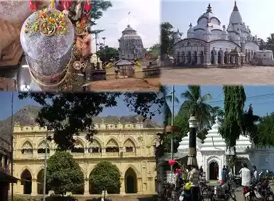
Tourist Places in Balasore District

| Chandipur beach | Direction Map |
| Chandaneswar Temple | Direction Map |
| Jagannath Temple Baleswar | Direction Map |
| khirachora temple | Direction Map |
| Panchalingeswar Temple | Direction Map |
| Talasari–Udaypur Beach | Direction Map |
FAQ
What is the main city of Balasore district?
Baleswar is the main town of the district
Why is Balasore district famous?
Baleswar is famous for the most attractive and enjoyable game of “Akhada”, played during Durga Puja by Hindus & during Moharrum by Muslims.
How many villages are in Balasore district?
There are 479 villages available in the district.
Why Balasore is called a missile city?
Chandipur Beach is also called ‘missile city’. The Indian Ballistic Missile Defence Programme’s Integrated Test Range is located 18 km south of Baleswar.
What is the new name of Balasore?
Balasore District, also known as Baleswar District.


